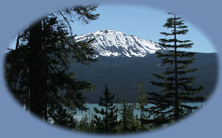
Mt Bailey with Diamond Lake
| |

| |
|
Mt Bailey, 5 miles south of beautiful Crater Lake National Park, abutted on the east by spectacular Mt Thielsen and to the north by Diamond Peak, offers a forest with an extraordinary history and spectacular natural attributes. Ancient forests, rich in diversity, living in a landscape shaped by the eruption of Mount Mazama, now known to most of us as Crater Lake, created by one of the most violent eruptions known to man. Unlike Mazama, which is a stratovolcano, Mt Bailey is a shield volcano, built upon the vestiges of an earlier mountain. In days of old, the Klamath tribe called it Medicine Mountain. According to legend, priests feasted on the summit and communed with the upper world. Today Bailey is a popular hiking and skiing site, due to its steep climbs and views of Diamond Lake. It is accessible from Oregon Highway 230, starting at the Fox Spring trailhead. Following the Mount Bailey Trail, part of the Diamond Lake Recreational Area, hikers can see "panoramas to the northeast of Diamond Lake and Bailey's dizzying avalanche bowl". Now, because of the threat of extraction, is the time to take steps to permanently protect this rich and diverse forest! Medicine Mountain National MonumentWe ask your help in establishing Medicine Mountain National Monument. The idea is not so new, early proposals for Crater Lake National Park included parts of this area in recognition of its outstanding beauty and ecological value. Preserved as a National Monument, Mt Bailey offers ample picture perfect views and abundant recreational opportunities. And it bears repeating, designation as a national monument would provide needed protection for an area whose natural beauty is threatened by extraction. The 206,000 acres that make up the proposed monument include popular destination points such as Mt. Bailey and Diamond Lake, abundant waterfalls, dozens of trails for all kinds of recreation and some of the most magnificent Ancient Forests remaining in the Pacific Northwest. Ancient forests and stunning geologic features left by the eruption of Mount Mazama are the basis of this diverse area. The boundaries of the proposed national monument fall entirely within the Diamond Lake Ranger District of the Umpqua National Forest plus Sherwood Butte on the Rogue River National Forest. Through its size and linkages between adjacent wilderness, this monument provides critical connectivity for many large-ranging and old-growth dependent species -- including 20 species of conservation concern. Protected status such as wilderness, parks and national monuments bring economic vitality to adjacent communities. Counties with relatively attractive environments and higher percentages of land devoted to wilderness, national parks, and national monuments are more likely to experience stronger economic growth. People are attracted by the quality of life these protected areas bring, which is largely based on the presence of healthy streams and intact native forests. Any negative impacts from a reduction in timber harvest could be offset by the benefits of designating a national monument. Conservation organizations are banding together to support the designation of the Medicine Mountain National Monument. A report prepared by Pacific Biodiversity Institute documents the scientific justification for designating this area as a National Monument under the Antiquities Act of 1906. Please join us in our efforts to protect this unique and amazing place in the Cascade Mountains. More information. | |
|
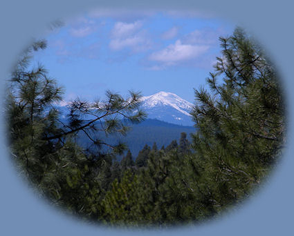
Forward ~ The north Santiam Decked out in wild Blackberries. Back ~ Mt Thielsen from the Diamond Lake viewpoint in the Cascade Mountains, off the Rogue Umpqua Scenic Byway in Oregon. USFS: The Rogue Siskiyou National Forest. Mountain peaks photographed from Crater Lake National Park pictured to the right beginning from the left: Mt Bailey, Diamond Peak and Mt Thielsen with Diamond Lake in the center. |
|
|
Explore the Diverse Loop Tour on the Crater Lake Hwy & Rogue Umpqua Scenic Byway: Directions, Map; and Scenery: waterfalls, hiking trails, the Rogue River Gorge at Union Creek, the Natural Bridge on the Rogue River, the Cascade Mountains, Diamond Lake, Crater Lake and more. Crater Lake on the the Umpqua Waterfall Tour, Hwy 138 or the Rogue Umpqua Scenic Byway: Travel Directions, Map and Scenery: wild and scenic rivers, waterfalls, hiking trails; equestrian trails, Crater Lake National Park; hot springs. Want to hike at Crater Lake National Park? Find the hiking trails at Crater Lake in Oregon. Travel Oregon and northern California while staying at Gathering Light ... a retreat | |

|
Travel on the Rogue Umpqua Scenic Byway to the retreat: Directions, Map & Scenery: hiking trails, waterfalls, the wild and scenic Umpqua River; Crater Lake and more. Travel Directions to and Day Trips in Oregon and California of around 100 miles from the retreat. Little known Scenic Places: hiking, sightseeing, wildlife viewing, canoeing, birding at wetlands and national wildlife refuges, and more near to the retreat and Crater Lake National Park: Directions, Map and Scenery. Website Directory for the travel pages Home Page |
|
Contact Brad at Gathering Light ... a retreat. Wood River Wetlands, Klamath Basin birding trails, pictured to the left, a mere 10 miles from Gathering Light. | |