|
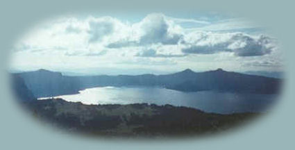
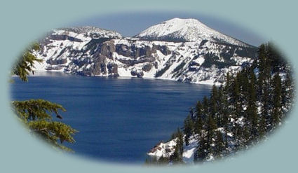
Trails in Crater Lake National Park Brad and I have hiked all these trails but Watchman Peak. The trail is 1.4 miles on the western rim. I never really cared about doing this hike, but now, thinking about it, it's across the lake from the other elevated hikes: Garfield and Mt Scott, and therefore would give an entirely different perspective, especially of Wizard Island. The hiking trail up Garfield PeakEvery hike has its own appeal, but for me, I must say, the hike on Garfield Peak is my favorite. It's a series of switchbacks moving toward and away from the lake. The picture of Crater Lake below and to the left was taken at one of the returns to the lake. The hike, with a gain in elevation of 1000 feet, is described as strenuous by park officials. It's 3.4 miles round trip, and offers so much: the lake, wildlife, the mountain, the stones, the plant life. I love this hike as no other. | |||

|
Castle Crest Wildflower Garden TrailWildflowers bloom from July - August, Munson Creek is beautiful and flows as late as August. It's a short stroll of 0.5 mile. | ||
Sun Notch ViewpointShort Stroll to the overlook of Phantom Ship and Crater Lake ~ .5 mile. Godfrey GlenGentle hiking trail overlook of Annie Creek Canyon ~ 1.0 mile. Cleetwood CoveThis hike is the only legitimate path to the lake. It's 2.2 miles and a definite hike. You can play in the water below if you don't plan on taking one of the boat trips. Friends of mine from the Netherlands walked down to the lake, and Jeroen, who loves to swim, took a dip in the lake, finding it very cold. The other day I was talking to a woman in McDonalds in Eugene. She was asking about the waterfalls on Hwy 138, and wanted to know where 138 was. I told her, and then told her that if she wanted to, she could end her journey in Crater Lake National Park, entering the park at the north entrance off of Oregon Hwy 138. She was quite elderly, and told me that years ago when visiting Crater Lake they'd walked down to the lake there in front of the lodge. Her visit must have been about 60 years ago, minimum. That trail isn't there anymore, and it wasn't there the next time they returned to the lake either. Annie Creek CanyonOn the southern perimeter of the mountain, the canyon is beautiful; the climb moderate. The loop trail offers a wide diversity in enjoyment, well worth the time and hiking, 1.7 miles. | |||
The hiking trail up Mt ScottMt Scott forms the eastern rim of Mt Mazama, and is the highest peak in the park. One gains an elevation 1,500 feet in the hike. You can find it when driving the eastern rim. (Mt Scott pictured to the right.) |

|
||
|
The expansive view from the peak of Mt Scott is portrayed somewhat on the Mt Scott page in this site. I say somewhat simply because at this elevation there is so much that can be seen. These hiking trails are not the only hikes of interest in the area of Crater Lake. Aside from the hikes we offer on the Diverse Loop Tour and the Umpqua Waterfall Tour, you might want to check out the Mountain Lakes Wilderness Area, Union Peak, Mt Thielsen (Thielsen acts as a lightning rod, make sure of weather conditions if you attempt this hike), Mt McLoughlin; Sky Lakes Wilderness Area, the Pacific Crest Trail, but by all means, don't stop there. :-) | |||
|
|
Forward ~ Little Known Special Scenic Places Back ~ Crater Lake Introduction. NPS: Crater Lake National Park Introduction to the Crater Lake pages. |
||
Explore the Diverse Loop and Umpqua Waterfall ToursCrater Lake on the Diverse Loop Tour, traveling the Rogue Umpqua Scenic Byway and the Crater Lake Hwy, Oregon Hwy 62: Directions, Map; Scenery: The Rogue River Gorge hiking trails, waterfalls, Cascade Mountains, Rogue Umpqua Scenic Byway and more. Crater Lake also on the the Umpqua Waterfall Tour, traveling the Rogue Umpqua Scenic Byway and the Crater Lake Hwy, Oregon Hwy 62: Travel Directions, Map and Scenery: enjoy sight seeing, wild and scenic rivers, waterfalls, hot springs. hiking; water sports. Sightseeing in Oregon and northern California while staying at Gathering Light. | |||
|
Travel the Rogue Umpqua Scenic Byway to the retreat: Directions, Map & Scenery: the Umpqua River, hiking trails, waterfalls; Crater Lake & more. Travel Directions to & Day Trips in Oregon and California of around 100 miles from the retreat. Hiking, wildlife viewing, birding & more near the retreat & Crater Lake: Directions Map & Scenery. Website Directory for the travel pages Home Page |

| ||
|
Contact Brad at Gathering Light ... a retreat. | |||