Taklema Gorge
| |
|
|
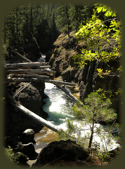
The river isn't always that peacefulBrad never wants to hike a trail longer than 4 - 5 miles. Since we live about 100 miles from the Rogue River, we don't take two cars. So, when we did this hike, we did it in two segments. On the first try we began at the Natural Bridge trailhead. From there we walked to Takelma Gorge. We came back the next week and this time began at River Bridge Campground, and again we walked to Takelma Gorge. We found different views each time, but not that different. The days were golden when we made the hike. It was glorious. Forward ~ Woodruff Bridge picnic area at the trailhead for the upper Rogue wild and scenic river hiking trail to Takelma Gorge. Back ~ Takelma Gorge on the other side of the bend. USFS: Rogue River Siskiyou National Forest in Oregon. Poison Oak can be a problem at these elevations. Want to see a picture. Indeed, I took this picture not far from here, at the viewpoint for Mill Creek and Barr Creek Waterfalls! |
|
The trail turns with the river. We made the bend, coming round the other side and this is what we saw. Obviously, the river isn't always as calm as it appeared on the golden autumn day when we made the hike. Below Takelma Gorge, the river widens and flows calmly past the Union Rogue Baptist Church Camp, while the trail returns to pumice flats along the river. Raptors, such as the shy goshawk, can be seen on this section of the river. The trail ends at the River Bridge Campground on Forest Service road 6210. From Prospect drive north on the Crater Lake Hwy, Oregon Hwy. 62 until you see the sign for the Woodruff Bridge Picnic Area. If you're heading north when you see it, turn left. If you're heading south, turn right. The trailhead is easy to find at Woodruff Bridge Picnic Area. Protect our National Forests and Wilderness Areas. Leave NO Trace! | |
|
Explore the Diverse Loop Tour on the Rogue Umpqua Scenic Byway and Crater Lake Hwy: Directions, Map; and Scenery: waterfalls, hiking trails, the Rogue River Gorge at Union Creek, Oregon, the Natural Bridge, the Cascade Mountains, Diamond Lake, Crater Lake and more. Or the Umpqua Waterfall Tour on the Rogue Umpqua Scenic Byway: Travel Directions, Map and Scenery: wild and scenic rivers, waterfalls, hiking trails, Crater Lake; hot springs. Combine the Diverse Loop Tour & Umpqua Waterfall Tour to travel the Rogue Umpqua Scenic Byway & Crater Lake Hwy: Directions & Map. Want to hike at Crater Lake National Park in Oregon? Find the hiking trails up at Crater Lake. Autumn hiking on the upper Rogue wild and scenic river hiking trail in Oregon, pictured to the right. |
|
|
Travel Oregon and northern California while staying at Gathering Light ... a retreat | |

|
Travel on the Rogue Umpqua Scenic Byway to Gathering Light ... a retreat: Travel Directions, Map & Scenery: hiking trails, waterfalls, the wild & scenic Rogue River, the wild & scenic Umpqua River; Crater Lake National Park & more. Directions to and Day Trips in Oregon and California of around 100 miles from the retreat. Little known Scenic Places to explore: wetlands, wildlife refuges, hiking, trails, sightseeing, wildlife viewing, birding, canoeing and more near the retreat and Crater Lake National Park: Travel Directions Map and Scenery. Website Directory Page Listings Home Page Contact Brad at Gathering Light ... a retreat. A winter walk along the river at Gathering Light, |
