The "Aufderheide", a National Forest Scenic Byway,
Find it on the West Cascades National Scenic Byway in Oregon
|

|
|
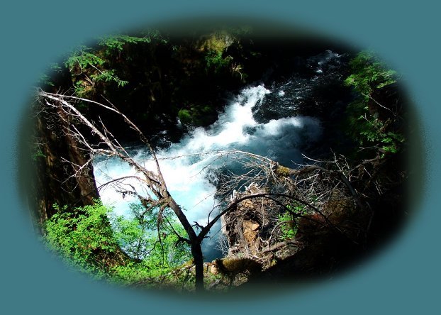
The Roaring River, located between the south McKenzie River and the north fork of the
Middle Willamette, a wild and scenic river on the West Cascades National Scenic Byway in Oregon.
|
|
The Aufderheide on the West Cascades National Scenic Byway, 70 miles of outstanding beauty and wonder, is clearly marked from the Willamette Pass, just west of the town of Oakridge, Oregon. The sign also says "Westfir", giving directions to a small community where the scenic byway begins.
The Aufderheide leads one first along the north fork of the middle fork of the wild and scenic Willamette River. If you get there early enough in the year, you'll find some great swimming holes. Regardless the time of year - the views are spectacular. Leave the Willamette behind and travel an expanse of national forest land before coming to the Roaring River, a tumbling churning flow of cerulean blue water. Not long after the Roaring River, find the south fork of the McKenzie River, a beautiful and charming flow. Stop at different turnouts to enjoy the view. Swim if you like. Continue and you'll find Terwilliger (Cougar) hot springs in the vicinity of Cougar Reservoir, known as the Cougar Recreation Area. Terwilliger hot spring is beautiful - six pools descending mountain steps & quite popular. A few years ago the forest service started charging a per person fee of $5.00, so plan ahead. The reservoir at Cougar Dam is great for boating, fishing, any water sport, and there are many campgrounds. After the reservoir, you'll come out on the McKenzie Pass, but before you make that new, and also, quite beautiful, journey, you might want to stop at Delta Campground. Perhaps you'll spend the night, regardless, you might seriously consider the Delta Old Growth Nature Trail. Delta Old Growth Nature Trail is only .5 mile; it's wheel chair accessible and some of the trees are 650 years old. Find the trailhead in the campground. When you're ready to, take on the McKenzie Pass and everything it has to offer, you won't be disappointed.
Check with the forest service to see the status of these trails, especially the Delta Old Growth Nature Trail. I think it may have burned in the Holiday Fire of 2020. Sadly.
|
|
If you want to explore this area more, check out the Tour of the Western Cascades Scenic Byway and/ or the Scenic Byway of the McKenzie Pass: Travel Directions, Map: page 1 and page 2, and Scenery.
Protect our National Forests and Wilderness Areas. Leave NO Trace!
Be sure to check out fire conditions at the Ranger Station before traveling,
hiking or camping in the forest.
|
|
Forward ~ Travel Directions on the Willamette Pass, Hwy 58.
Back ~ Hiking trails on the McKenzie Pass - Santiam Pass Oregon Scenic Byway.
Brad and I invite you to explore the West Cascades National Scenic Byway: Directions, Map and Scenery, and also, the Willamette Pass in the Cascade Mountains: Directions, Map and Scenery. If you're interested and have a suitable vehicle, try the Crescent Lake Oakridge "inback" Tour as Brad calls it. Enjoy wild and scenic rivers, waterfalls, hiking trails, old growth forests, campgrounds, lakes, scenic byways, mountains and volcanoes and more.
|

|
|
Travel Oregon and northern California while staying at Gathering Light ... a retreat
located in southern Oregon near Crater Lake National Park.
|
|
Travel the West Cascades National Scenic Byway to the retreat: Directions, Map & Scenery & the Willamette Pass, Hwy 58: Directions, Map & Scenery.
Travel Directions to and Day Trips of around 100 miles the retreat.
Little known Scenic Places: hiking, sightseeing, wildlife viewing, birding & more, all near Crater Lake & the retreat: Directions Map & Scenery.
Website Directory for the travel pages Home Page
Page Listings to the travel pages
|

|
|
Contact Brad at Gathering Light ... a retreat.
|
