|
The West Cascades National Scenic Byway: | |

| |
|
Travel to Gathering Light ... a retreat on the West Cascades National Scenic Byway. | |
|
|
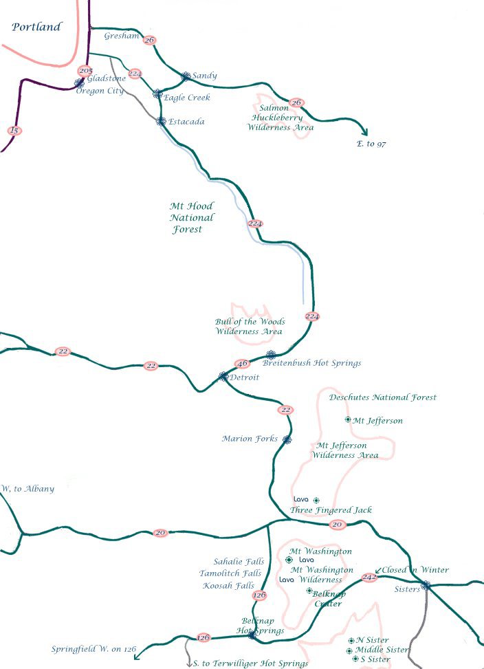
Forward ~ Map of the West Cascades National Scenic Byway, the southern section. Back ~ Travel Directions for the West Cascades National Scenic Byway. USFS: The Willamette National Forest. USFS: Deschutes Ochoco National Forest. The West Cascades National Scenic Byway, 220 miles of unparalleled beauty, one vista after another: the Cascade Mountains, hiking trails, waterfalls, mountain lakes, old growth forests, spectacular lava flows, volcanoes, wilderness areas and more: Travel Directions, Map, the southern section, & Scenery. Koosah Waterfall on the McKenzie River, part of the West Cascades National Scenic Byway, pictured to the right. Enter the byway at Portland, farther south at Salem, at Sweet Home and/or Eugene, depending on your preference. |
|
Travel Oregon and northern California while staying at Gathering Light ... a retreat located | |
|
Travel to the retreat on the West Cascades National Scenic Byway: mountains, volcanoes, hiking trails, wild and scenic rivers, hot springs, scenic byways, McKenzie River National Recreation Trail, waterfalls. Travel Directions, the Map, the southern section & Scenery & the Willamette Pass, Hwy 58: Directions, Map & Scenery. Travel Directions to and Day Trips of about 100 miles from the retreat. Little known Scenic Places near the retreat and Crater Lake National Park: hiking, mountain biking, fishing, canoeing, kayaking, National Wildlife Refuges, Williamson River Gorge, and more: Directions, Map and Scenery. Local Maps Introduction. Website Directory for the travel pages
Home Page Contact Brad at Gathering Light ... a retreat. Wood River Wetlands one of the birding areas not far from the retreat, pictured to the right. |

|