Diamond CreekHiking trails in the Diamond Peak Wilderness in the Willamette | |

| |
|
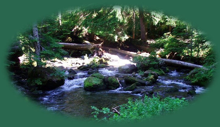
Travel Oregon and ... Diamond Creek, part of a waterfall loop hiking trail accessed at Salt Creek Waterfalls Wayside on the Willamette Pass through the Cascade Mountains, just one of several hiking trails to be found in the Willamette National Forest of Oregon. Diamond Creek as portrayed in this photograph is accessed by descending stairs, carved out of logs to the canyon below. The descent is somewhat steep, and is in need of some maintenance, but it's still easy and don't miss it. The view is not spectacular, but certainly worth seeing it. (Smile ...) Map to the hiking trails at Salt Creek Waterfalls. Whether traveling east of west, be sure to stop at McCredie Hot Springs, at Salt Creek Waterfalls and try out the hiking trails to waterfalls, see Diamond and Falls Creeks, mountain lakes and Diamond Peak Wilderness. And don't forget, the Willamette National Forest offers many recreation opportunities for the water enthusiast: Sailing, Fishing, Swimming, Picnicking and more. The area offers hiking trails and waterfalls in the Willamette National Forest at Salt Creek Falls & at the Waldo Lake nearby, as well as, the beautiful scenery of the Cascade Mountains. Protect our National Forests and Wilderness Areas. Leave NO Trace! |
|
Forward ~ Diamond Peak on the Willamette Pass Back ~ Upper Diamond Creek Waterfall.
USFS: Willamette National Forest |
|
Explore the Willamette Pass, Oregon Hwy 58, in the Willamette National Forest of the Cascade Mountains in Oregon: Hiking trails, the Waldo Lake Wilderness and the Diamond Peak Wilderness, Salt Creek Waterfalls, hiking trails to Diamond Creek Waterfalls, mountain lakes, waterfalls, fishing, boating, swimming, camping, snow skiing cross country skiing, and snow boarding at the summit, snowmobile riding and more: Directions, Map and Scenery. Want to hike or cross country ski? Try the trails at Salt Creek. Perhaps try an alternative scenic route toTravel Oregon. Travel along the Middle Fork of the Willamette River. Call about road conditions first. If you're heading west on the Willamette Pass, the route given on the site goes east, you might want to connect with the West Cascades National Scenic Byway. Travel Directions, Map: page 1 and page 2, and Scenery: offering mountains, hardened lava flows, wild and scenic rivers, waterfalls, hiking trails, hot springs, old growth forests, mountain lakes, forest service campgrounds. The West Cascades National Scenic Byway provides easy access to the Three Sisters Wilderness, the Mt Jefferson Wilderness and the Mt Washington Wilderness, all located in the Willamette National Forest. Travel Oregon and northern California while staying at Gathering Light ... a retreat |

|
Travel to the retreat on the Willamette Pass, Oregon Hwy 58: Travel Directions, Map and Scenery. Find hiking trails, the Waldo Lake Wilderness and the Diamond Peak Wilderness in the Willamette National Forest, Salt Creek Waterfalls, hiking trails to Diamond Creek Waterfalls, Diamond Peak & Mt Yuron, Odell Lake. Directions to & Day Trips of about 100 miles from the retreat. Little known Scenic Places: hiking sightseeing, wildlife viewing, birding & more near Crater Lake & the retreat: Travel Directions Map and Scenery. Website Directory for the travel pages Home Page |
|
Contact Brad at Gathering Light ... a retreat. |