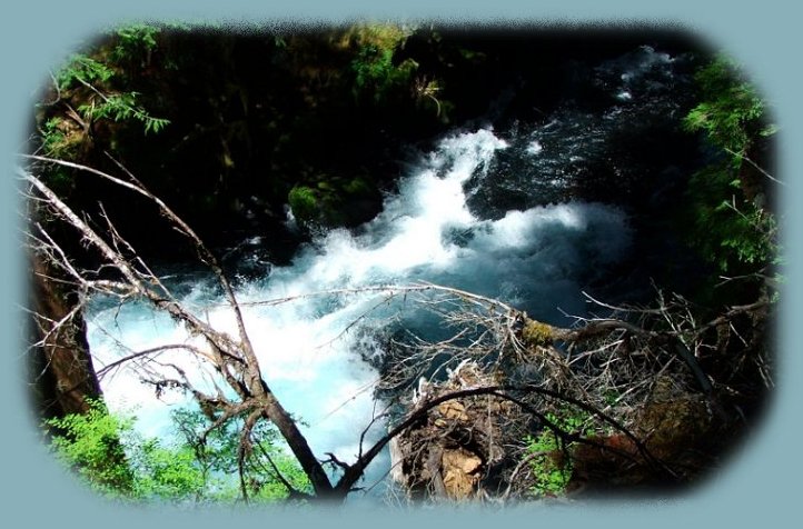
The West Cascades National Scenic BywayThe Roaring River | |||
|
| |||
The Roaring River in AugustLate August on the "Aufderheide" and the rivers are low, but beautiful, even so. You may want to extend the West Cascades National Scenic Byway Tour to include the Willamette Pass in the Cascade Mountains: Travel Directions, Map and Scenery and the Crescent Lake, Oakridge "Inback" Tour, which follows the Middle Willamette River and provides easy access to the Diamond Peak Wilderness: Travel Directions and Map. The West Cascades National Scenic Byway provides easy access to the Three Sisters Wilderness, the Mt Jefferson Wilderness and the Mt Washington Wilderness, all located in the Willamette National Forest. The Aufderheide portion provides easy access to the Three Sisters Wilderness. Protect our National Forests and Wilderness Areas. Leave NO Trace. | |||
|
|
Forward ~ The north fork of the middle fork of the Willamette River - the Wild and Scenic Willamette River. Back ~ Autumn on the South McKenzie River USFS: Willamette National Forest. Explore the West Cascades National Scenic Byway: Travel Directions, Map: page 1 and page 2, and Scenery: offering mountains, hardened lava flows, wild and scenic rivers, waterfalls, hiking trails, hot springs, old growth forests, mountain lakes, forest service campgrounds. | ||
While you're out and about you might want to extend your visit and ...Discover the splendor of the McKenzie Pass - Santiam Pass Oregon Scenic Byway, Hwy 242: Directions to hiking trails. The Scenic Byway can be accessed either in Sisters, Oregon or from Hwy 126, the McKenzie Pass. Find the turnoff two miles east of the Ranger Station for the Willamette National Forest. Sites to see. If you're heading east on the McKenzie Pass, Hwy 126, of the West Cascades National Scenic Byway, you may want to make a loop from the McKenzie Pass, Hwy 126, and connect with the Over the River and through the Woods Scenic Byway, Hwy 20. The sign for Hwy 20 is clearly marked from Hwy 126. If you see the sign for Belknap Hot Springs, you've gone too far. Take the cutoff for Hwy 20, the Over the River and through the Woods Scenic Byway and find the graceful South Santiam River, lovely campgrounds and Hiking Trails to wildflowers, amongst old growth forests, in both the old and high Cascades of the Willamette National Forest: Directions to and Descriptions of Trails and Campgrounds. Travel Oregon and northern California while staying at Gathering Light ... a retreat | |||

|
Travel on the West Cascades National Scenic Byway to Gathering Light .... a retreat: Directions, Map and Scenery: hiking trails, waterfalls, wild and scenic rivers, mountains, volcanoes, hot springs, Oregon scenic byways, wilderness areas and more. Travel Directions to and Day Trips of about 100 miles from the retreat. Little known Scenic Places to explore and photograph nature untrammeled: hiking with and without trails, wetlands, wildlife refuges, mountains, river gorges, wilderness areas and more near Crater Lake and the retreat: Travel Directions Map and Scenery. | ||
|
Contact Brad at Gathering Light ... a retreat. | |||
