|
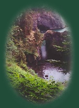
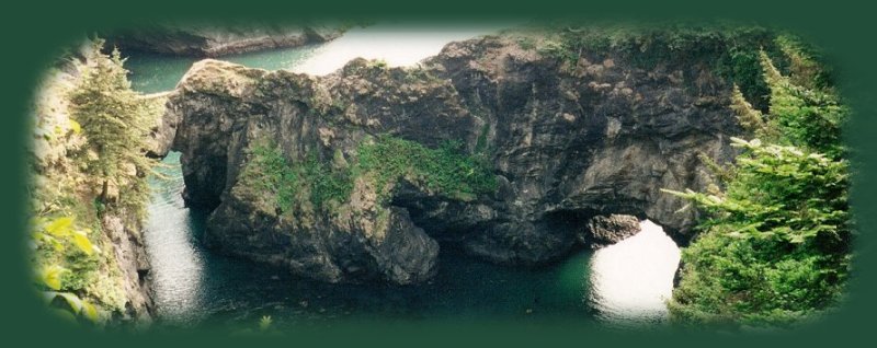
The Natural Bridge at Samuel J Boardman State Park on the southern Oregon coast is but a part of several
geological wonders witnessed as nature's wonder on the Oregon coast. It's located 5 miles north of Brookings, Oregon and
included as a segment of the Oregon Coast Trail. The length of the park is 20 miles along the coast and that means 20 miles of
spectacular beauty, coastal headlands, hiking trails and more. Included within the park are: Arch Rock, Miner Creek and
"Secret Beach," Thomas Creek Bridge, Thunder Cove, House Rock, Whaleshead Beach,
a herd of wild goats and so much more ...
As far as hiking goes, this area of the beach is full of wonders. I will include directions and scenery at some point, but
for now I will list some of the viewpoints. Arch Rock is obvious. I grew up in the Portland Metropolitan area, so we stayed
pretty much on the northern coast, One summer dad had a contract for work at Sunset Bay on the Oregon Coast, not
far from Coos Bay. We spent the summer there, traveling all over, and I never forgot Arch Rock. I didn't remember
the name or anything concrete like that. I just recognized it as an old friend when I saw it again as an adult.
What's to find besides scenery at Arch Rock: an easy trail along the coast, a paved loop, several picnic tables,
vault toilets, but no running water.
Certainly, you must stop to view the natural bridge and walk down the trail.
Thomas Creek Bridge, at 345' is the tallest bridge in Oregon. House Rock Viewpoint; Spruce Island
Viewpoint, Spruce Island is interesting. Sometimes you can see a herd of wild goats out on the island. I took photographs of
them out on the sea stacks once, but my camera couldn't due them justice. I'll try again with my
present camera if the opportunity ever arises.
|
| |

|
Forward ~ Walk above the Pacific Ocean
on the Natural Bridge, page 2.
Back ~ Trail to the Natural Bridge at Samuel
J Boardman State Park.
Scenery en route to and on the Oregon and California Coast.
Directions when traveling south from Waldport, Oregon on the Pacific
Coast Scenic Byway and when traveling north.
USFS: Hiking Trails on the Oregon Coast.
Brad and I invite you to take the Road Less Traveled:
Leisurely routes to the Oregon Coast, those that meander along
streambeds and river canyons.
|
|
| |

|
Advertise Here!
Links pertaining only to the retreat open a new window.
Travel to Gathering Light ... a retreat on the Umpqua Scenic Byway.
Follow the Umpqua River from Reedsport, to Sutherlin and from there head south on I - 5 10 miles to Roseburg, Oregon, Access the Umpqua Scenic Byway: Travel Directions, Map and Scenery.
Travel Directions to and Day Trips of about 100 miles from the retreat.
Little known Scenic Places to explore nature untrammeled:
hiking with and without trails, wildlife refuges, wetlands, mountains, river
gorges, wilderness areas and more near Crater Lake and the retreat:
Travel Directions Map and Scenery.
|
|

