|
This information is by no means comprehensive, but it gives some good information.
Perhaps you've decided to travel from the Willamette Valley to the coast along the Alsea River, as described in the Road Less Traveled. When you arrive in Waldport, take Pacific Coast Scenic Byway south. Enjoy the spectacular coast line, stop and spend at least one night at Beachside State Recreation Site just south of Waldport. Beachside is just seconds from the ocean, an excellent location for whale or wave watching, and nicely located with respect to visitor centers, tide pools, hiking trails and driving tours. Cape Perpetua Scenic Area, south of Waldport: You've heard the complaint "So much to do, so much to do." You've probably made it yourself in the past. :-) Well, that certainly applies here. Cape Perpetual offers hiking trails that give spectacular views of coast and the Pacific Ocean for miles and miles. Nature walks, tide pools, crashing waves, hands on and educational opportunities for young and old alike at the Visitor's Information Center, interpretative walks given by forest service personnel, old growth forests, a spectacular drive as Hwy 101 follows the coast line. Camp in the area too if you like. Seemingly, the only complaint one could make, provided the weather is fine, is "so much to do, so much to do."
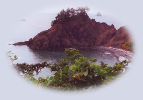
Just so you know, Cape Perpetua is a fee use area. Check with the USFS: Siuslaw National Forest for more information. If you like to wander further, head on south for a visit to Carl Washburne State Park and Heceta Head Lighthouse 13 miles north of Florence, Oregon. The lighthouse is a spectacular view in itself, but stop and take advantage of the spectacular views from the headlands. Hiking trails expand this opportunity, as well as a hike that leads to Carl Washburne State Park, on the northern boundary. Carl Washburne has a long coastline for walking, playing in the ocean, flying kites, building sandcastles, whatever ... The park has restrooms (flush toilets) and some picnic tables. It's not a fee use area and is quite popular. I've never seen it overcrowded. The Sea Lion Caves, 11 miles north of Florence: Generally speaking Sea Lions can be viewed sunning themselves on the rocks and playing in the ocean outside the caves during spring and summer. The caves are their rookery and usually provide shelter during autumn and winter. This is a privately owned business with fees that can change, so I won't list them here. If you want to know more, check them out. Be sure to take in the many offerings in Florence, certainly don't forget old town. Florence marks the northern boundary of the Oregon Dunes National Recreation Area. The dunes run along the coast line for 56 miles south to Reedsport, Oregon. They're the largest expanse of coastal sand dunes in North America. Although the dunes offer a desert like landscape, they blend remarkably with lakes, rivers, ocean and forests, creating a diverse ecosystem with varied plant and animal life. Spend time there, enjoying the myriad recreation opportunities: Off highway vehicle riding areas, hiking trails, spectacular views, canoeing, water skiing, swimming, scuba diving, fishing, wetlands, forests. I am very familiar with the area of the coast south of Reedsport. While I haven't spent as much time there as I have on the northern coast, I have spent enough that everything just runs together in my mind when I try to elucidate it. Nevertheless, I can give a brief rundown and then fill everything in when I make my way over there again. Get off Hwy 101, which swerves away from the coastline at Coos Bay, and take Cape Arago Hwy out to Cape Arago Lighthouse, Sunset Bay State Park, Shore Acres State Park and Cape Arago State Park. Cape Arago marks the end of the road. This is a beautiful area. Certainly one not to be missed. I will go into great detail when I have more specific facts to share. However, I can tell you that Sunset Bay provides spectacular coastal recreational opportunities. Again, so much to do. Cape Arago serves as a viewing platform, so to speak, for whale watching and watching other sea mammals as well. The park offers hiking trails: the south trail leads to a sandy beach, tide pools where you can look at intertidal plants and animals - please don't touch. The north cove trail gives opportunity for fishing, beachcombing, viewing seals and sea lions at the offshore colony of Shell Island, a designated national wildlife refuge. The trail is closed March 1st through June 30th to protect the newborn wildlife. Picnic tables, restrooms and a gazebo shelter are available for day use. There is no charge for this park. First come, first served. Hike to Sunset Bay State Park from Cape Arago or drive a little farther.
|
|
Our Getaways offer written Directions, Maps and suggested scenery, spanning Oregon and northern California; places Brad and I have visited and loved. These getaways offer simplicity, yet beauty in scenery, waterfalls, hiking trails, campgrounds, mountains, hot springs, mountain lakes, equestrian trails, mountain biking trails, wild and scenic rivers, ocean beaches, old growth forests, wildlife refuges, wetlands, camping and picnicking at state parks, scenic byways, Crater Lake National Park, national monuments and more.
Protect our National Forests and Wilderness Areas. Leave NO Trace! Be sure to check out fire conditions at the Ranger Station before traveling, hiking or camping in the forest.
|
|
Travel the Rogue Umpqua Scenic Byway to the retreat: Follow the Umpqua River from Reedsport to Sutherlin. From there head south on I - 5 10 miles to Roseburg; access the Rogue Umpqua Scenic Byway, Hwy 138: Directions, Map & Scenery.
Directions to & Day Trips of about 100 miles from the retreat.
Scenic Places near Crater Lake & the retreat: hiking, sightseeing, wildlife viewing, birding, & more: Directions Map & Scenery.
Website Directory for the travel pages Home Page
Page Listings to the travel pages
|

|
