Travel Directions to
| |

| |
|
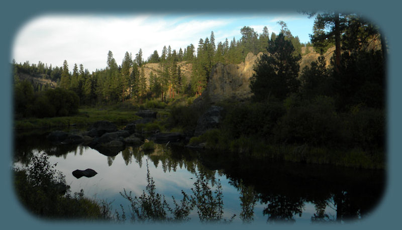
The lower gorge on the Williamson River in autumn's twilight. The Williamson River Gorge on the Lower Williamson River Gorge Hike/Walk: Follow Map as indicated to the turn off for Collier State Park campground. Turn onto that road; immediately the road forks, take the road to the left. In about 1.5 miles the road will fork again, stay left, then take the first dirt road on the left. You’ll see the rock bluffs ahead; the road will turn right & head east running parallel to the bluffs. Continue on that road until it dead-ends at the entrance to the lower gorge. Moderate Vehicle Clearance. Upper Williamson River Gorge Hike: Follow Map as indicated as if driving to Collier State Park. Don’t turn off at the park, but stay on 97. You’ll drive over a bridge & up a hill. Approximately 5 miles after the bridge look for a sign on the right, which says, “Deer Next 26 Miles.” Immediately after the sign, you’ll see three dirt roads on the right. Take the middle one. Follow it east, don’t take any turnoffs; look for a big pine clearing on the bluff overlooking the gorge. When you arrive at the rock bluff over looking the gorge, find a place to park & hike down into the gorge. The total length of the gorge in its entirety is 5 miles. Note: If you’re considering an attempt at the middle gorge, it “tunnels” & is all but impassable. Moderate Vehicle Clearance. . | |
|
Protect our National Forests and Wilderness Areas. Leave NO Trace! | |
|
Forward ~ Introduction to Shoalwater Bay at Eagle Ridge in Klamath Basin. Back ~ Little known special places near the retreat and Crater Lake National Park. NPS: Crater Lake National Park USFS: Fremont Winema National Forest. Explore nature untrammeled: hiking with and without trails, birding trails, wildlife refuges, wetlands, river gorges, mountains, wilderness areas and more in Nearby Scenic Places: Directions, Map and Scenery. |
|
|
Travel Oregon and northern California while staying at Gathering Light ... a retreat | |

|
Travel on the Willamette Pass, Oregon Hwy 58, to the retreat: Directions, Map and Scenery: hiking trails, mountains and lakes. Travel to the retreat along the wild and scenic Umpqua River: Travel Directions, Map and Scenery: hiking trails, waterfalls, the wild and scenic Umpqua, Crater Lake and more. Directions to and Day Trips of around 100 miles from the retreat. Website Directory for the travel pages
Home Page Contact Brad at Gathering Light ... a retreat. |