Oregon Hiking TrailsTwin Lakes
| |

|
Forward ~ Campgrounds in the Diamond Lake District of the Umpqua National Forest Back ~ Scenery on the Wild and Scenic Umpqua River and Tributaries. USFS: The Umpqua National Forest of Oregon. BLM Roseburg District of the Bureau of Land Management. There are two ways to approach Twin Lakes. Brad and I took the eastern route, which I describe in some detail below. If you're approaching Twin Lakes from the west, take the turnoff to follow the Little River at Glide, Oregon. Continue on Little River Road for 20 miles when it wil turn into FS 27, a gravel road. Stay on Rd. 27, you'll come to Lake in the Woods Campground. - If you want to make an extended journey of your trip, stop at the campground for Lake in the Woods and take the hikes to beautiful Yakso Waterfall on the Little River and Hemlock Falls on Hemlock Creek. Whatever you decide, you need to continue past Lake in the Woods on FS 27 for about 3 miles where you'll turn left on 2715. Follow 2715 for 8 miles to Road #2715-530. Turn left. At the end of the road find the trailhead for Twin Lakes Trail #1500. |
|
To approach from the east: Driving on Oregon Hwy 138, the Rogue Umpqua National Scenic Byway, perhaps your journey originated at Crater Lake National Park, Diamond Lake or other points east: Once you see the sign for Toketee Waterfalls on your right, you'll know that it's about 6 miles to the turnoff for Twin Lakes. Soon the Umpqua River will appear on your right. Not long after Boulder Flats campground you'll see the sign for Twin Lakes. You don't want the river to be on your left, so turn left immediately before the river moves onto the other side of the road. After turning, you'll be on FS 4770. If by some chance you do find the river on your left, you need to turn around, cross the bridge, turn right to be on FS 4770. FS 4770 is where you want to be. After turning, you can stop to take in a nice view of the Umpqua at a pull out. Otherwise, keep going. You'll see a sign that says 10 miles to Twin Lakes, and that's what it says in the site for the Umpqua National Forest, but it's not quite 10 miles. I always check my odometer when embarking on such a journey as this, and the trailhead was a little more than 9 miles from the sign. I tell you this because Brad thought we should continue on this road that was barely a road anymore. I kept saying that this had to be the trailhead, and I refused to take my car - a street car on that road. As it turned out, the wide opening in the road is the trailhead. :-) | |
|
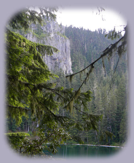
The forest is quite lovely on the drive up there. As I said, when the road opens up with a parking area and a vault toilet, you'll know you're at the trailhead. Look for the trailhead off to the right. There's a signboard such as are quite familiar in national forest campgrounds, at trailheads, etc. Take the trail through stands of old growth Doug Firs. In a short distance, the trail offers a turn to the right or left, with no sign indicating the way to go. Turn to the right. Soon after you'll see a sign that says 1 mile to Twin Lakes, and gives information about accessing the trailhead to Twin Lakes from the west. Not long after this the vista will open up. It's there you can a sense of expansive grandeur with views of mountains and forests that go on for miles. Throughout this hike, you'll find the trail banked by garlands of wildflowers. We were there on July 20th, so that gives you an idea of what to expect. If you go earlier, you can see a veritable flower bed of wild rhododendrons along the trails that encompass the lakes. We were too late for that. Still, the trail is characterized by expansive meadows brimming with wildflowers right up until you get your first view of the Big Lake. Before the lake however, the cliff that abuts both lakes comes into view, a promise of what's to come. |
|
|
At your first sight of the lake, I suppose the beautiful blue green waters make the greatest impression, followed by forests, a hand carved picnic table and shelter - not anywhere as nice as the one yet to come at Little Twin lake. As you're standing there, looking at the lake, you can turn around and see carpets of wildflowers blooming in the meadows that grace the lake. After this, we turned to the right to take the trail around the lake. We followed this until we could see the turnoff to Little Twin lake, which we took and walked around the smaller lake. Both of us found Little Twin lake more beautiful than the big lake. You can get an idea when you look at the pictures in the Twin Lakes section of this site. As we completed the circuit of the lake we connected once again with the trail around the big lake. After completing that, we spent some time there on the lake before heading back down. Again, and I know I've said it elsewhere, this experience is beyond words. The next time we go, we're spending the night. Protect our National Forests and Wilderness Areas. Leave NO Trace! To make sure we do it all, Check the 7 Principles of "Leave NO Trace!". | |
Big Twin LakeBig Twin Lake is a 14-acre lake with depth of 48'. Try fishing for Brook Trout. The Umpqua National Forest website says there are six campsites with rustic picnic tables and fire rings. I did not see six campsites, but that could have quite likely been because our focus was on the lake as we hiked around it. I saw one immediately as we first approached the lake, and then no more. However, if the campsites were separated from the lake by trees, and there are lots of trees and rhododendrons bushes around the lake, my view would have been blocked. I did see the shelter as mentioned previously. There is a pit toilet at the trailhead, and perhaps another one on the lake. I can't say for certain. Little Twin LakeLittle Twin Lake is a 6-acre lake with a depth of 30 feet. It has one campsite and shelter, which can be seen on the Twin Lake pages in this site. |
|
|
Both lakes are connected by a 1 mile loop trail. Activities include: amping, picnicking, hiking, swimming, fishing for brook trout, boating (canoe or inflatable craft) and photography. Any surface water should be treated before drinking. No motorized traffic is allowed on either of the lakes. Shooting firearms in the proximity of the Twin Lakes is prohibited. The website for the Umpqua National Forest says the hike can be made year round, but the elevation is 5000' so keep that in mind. As a word of warning: I wanted to drive out to Twin Lakes on another occasion. The only thing I knew about Twin Lakes was the sign from Oregon hwy 138. When I crossed the bridge, I pulled off the road. A man was there looking at the river, watching for signs of spawning Steelhead. He worked for the forest service. He told me that 4770 was not a very good road. He didn't think I should go up there by myself, and I decided not to. Later when Brad wanted to go, I was happy to accompany him. And I always will be happy that we went. It was a wonderful occasion - practically beyond words. Still, when we were coming down I remembered the words of the Forest Ranger that day. FR 4770 was so badly washboarded that I had to seriously concentrate on my driving. The descent is steep, and though I had the car in 1st gear, I was never able to take my foot off the brakes. At the last short distance when the road does level out to follow the Umpqua River, I could smell the asbestos of my brakes. My brakes were new, and seriously, I was glad. We had decided to drive down to Dry Creek after we came down, a mere 5 miles further west on Oregon Hwy 138, and I could smell the asbestos there as well. I could still smell it the next morning. So, while this hike is worth every difficulty, just make sure you have good brakes before going up there. :-) | |
|
|
Oregon Hiking TrailsTwin Lakes
|
| |

|
Travel to the retreat on the Umpqua Scenic Byway: Travel Directions, Map and Scenery: hiking trails, waterfalls, wild and scenic rivers, mountains, sightseeing and more. Directions to and Day Trips in either Oregon or California of about 100 miles from the retreat. Little known Scenic Places to explore nature untrammeled near Crater Lake and the retreat: hiking with and without trails, mountains, wilderness areas, mountain lakes, wildlife refuges, wetlands and more: Directions, Map and Scenery. Website Directory for the travel pages Home Page Contact Brad at Gathering Light ... a retreat. |
|
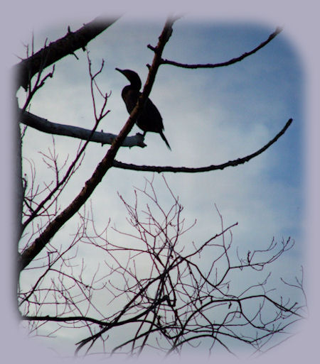
Peleagic Cormorant at Wood River Wetlands (pictured above), one of the many Klamath Basin birding trails not far from Gathering Light ... a retreat. Rustic simplicity, a place to "Just Be", Gathering Light is nestled on the banks of the river, surrounded by the Fremont Winema National Forest of southern Oregon and not far from Crater Lake National Park. | |