The Rogue River Escape at the Natural Bridge
| |
|
| |
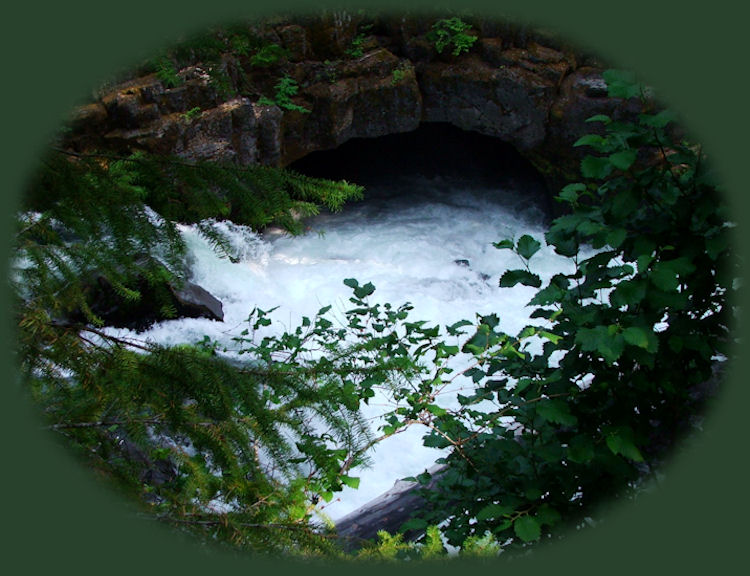
The Rogue River in high dudgeonThe Natural Bridge on the Rogue River is a geologic phenomenom, formed as part of the tectonic forces that gave form to the state of Oregon, beginning about 100 million years ago. At the Natural Bridge, the Rogue river flows underground into a maze of lava tubes, with but a small portion of that escaping into a small pool just below the natural bridge. The rest of the flow surges back to the surface where it is visible from the viewpoint bridge. The largest returning underground flow escapes from under the east bank into the main channel, as depicted in the photos above and below, to the left, With these "escapes" the river returns again to full strength. The upper Rogue wild and scenic River Hiking TrailThe upper Rogue wild and scenic River Hiking Trail follows the Upper Rogue River from Boundary Springs to Prospect, Oregon. It can be hiked in segments. If desired, one can hike upstream from the Natural Bridge along the Rogue, or hike downstream. The segment of the trail beginning at the Natural Bridge is accessed 0.5 mile west of Highway 62, near the Natural Bridge Viewpoint bridge. The route winds along the bank over a rough tread of mossy lava rock which becomes very slippery in wet weather. Vegetation along the trail alternates between sheltering old-growth forest and brush, while the river's character varies between rapids and pools of quiet water. The trail climbs high above the river where it bends sharply and rages through the narrow chute of a collapsed lava tube. This beautiful rapids is known as Knob Falls. One encounters several old skid roads when nearing Woodruff Bridge, the end of this segment of the Rogue River National Hiking Trail. Picnic if you like at Woodruff Bridge, and a developed picnic area is available. This spot is also a favorite for fishing. Be careful around the river. It can flow very fast and hard, and also, it can be quite cold. It's best to be prepared.:-) Poison Oak can be a problem at these elevations. Want to see a picture. Protect our National Forests and Wilderness Areas. Leave NO Trace! | |
|
|
The Rogue River
|
|
Explore the Diverse Loop Tour on the Rogue Umpqua Scenic Byway and Crater Lake Hwy, Oregon Hwy 62: Directions, Map; and Scenery: waterfalls, hiking trails, the Rogue River Gorge at Union Creek, Oregon, the Natural Bridge, the Cascade Mountains, Diamond Lake, Crater Lake and more. Or the Umpqua Waterfall Tour on the Rogue Umpqua Scenic Byway: Travel Directions, Map and Scenery: wild and scenic rivers, waterfalls, hiking trails, Crater Lake; hot springs. Combine the Diverse Loop Tour & Umpqua Waterfall Tour to travel the Rogue Umpqua Scenic Byway & Crater Lake Hwy: Directions & Map. Want to hike at Crater Lake National Park in Oregon? Find the hiking trails up at Crater Lake. Travel Oregon and northern California while staying at Gathering Light ... a retreat | |
|
Travel on the Rogue Umpqua Scenic Byway to Gathering Light retreat: Travel Directions, Map & Scenery: hiking trails, waterfalls, the wild & scenic Rogue River, the wild & scenic Umpqua River; Crater Lake National Park & more. Directions to and Day Trips in Oregon and California of around 100 miles from the retreat. Little known Scenic Places to explore: wetlands, wildlife refuges, hiking, trails, sightseeing, wildlife viewing, birding, canoeing & more near the retreat and Crater Lake: Travel Directions Map and Scenery. |

|
|
Contact Brad at Gathering Light ... a retreat. The nature pond in the backyard of Cabin 2 depicted above. | |
