California Coast Redwoods, the three northern most state parks
The California Coast Redwoods survive in continuous belt from California up into Oregon. Great numbers of the trees were logged over a century ago. Due to the foresight of the Save the Redwoods League and the state of California, many were preserved beginning in the early 1900s. The Stout Grove in Jedediah Smith Redwoods State Park was the first grove set aside. Prairie Creek Redwoods State Park was set aside in a few years later in 1920, Jedediah Smith Redwoods State Park and Del Norte Coast State Park were created in 1929. Redwood National Park, completing the southern end of the northwest section of Redwood Parks, was set aside in 1968. The four parks together make up 45% of the old growth forests remaining in the state.
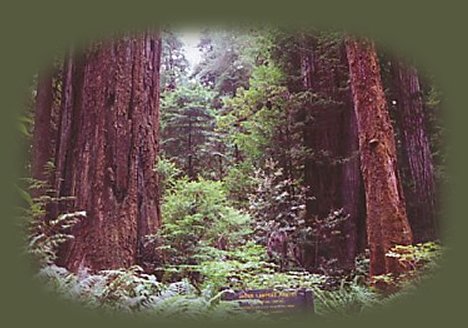
The California Coast Redwoods survive along the coastline in Oregon and California below elevations of 2,000'. The morning fog, heavy winter rains, and mild temperatures create optimum conditions for growth. Some trees are as old as 2000 years and show no signs of dying. Trees can grow as tall as 350' with diameters of 20'.
Jedediah Smith Redwoods State Park near the Oregon California border, nine miles east of Crescent City. Del Norte Coast Redwoods State Park west of Jedediah Smith Redwoods State Park, near Crescent City. Prairie Creek Redwoods State Park 25 miles south of Crescent City on the coast at the Oregon California border and 50 miles north of Eureka, near Klamath. The Redwoods National Park.
Jedediah Smith Redwoods State Park
9 miles east of Crescent City, California on Hwy 199, otherwise known as the Redwood Hwy. Or, if you're traveling from Grants Pass, Oregon, portal to the Redwood Hwy, Jedediah Smith Redwood Park begins not too long after you cross the border. A visitor Center right off Hwy 199. Offers a campground that accommodates trailers up to 35' (but no hookups); reservations are recommended from June to Labor Day in September for the 106 sites. Each campsite offers a fire ring, a fairly level picnic table, and bear locker with restrooms and hot showers close by. Hike and bike campgrounds are not reservable. Wheelchair accessible features include: fairly level ground around picnic tables, some campsites and trails to the restrooms, the route from the parking lot to the visitor center, water spigots in the campground, restrooms in the picnic area. Check in the event these features have changed. The Picnic Area near Smith River offers tables and stoves. It's located on the Smith River, so swimming is popular although no lifeguards are available, and the river can be treacherous. A footbridge makes crossing the river possible and from there stroll along the trails in Stout Grove. This is a very lovely walk! ;-) Fishing in Smith River is quite good: Cutthroat Trout during the summer, Salmon and Steelhead during their runs. Around 20 miles of hiking trails, as well as equestrian and biking trails.
Del Norte Coast Redwoods State Park
The park is located 7 miles south of Crescent City on coastal cliffs with an elevation that rises from sea level to 1277'. Due to the steep topography, the eight miles of wild coastline is primarily accessible only by hiking trails: Damnation Trail and Footsteps Rock Trail. Either Wilson Beach or False Klamath Cove is suitable for leisurely walks along the ocean and viewing marine life in tide pools, but not for swimming. The shoreline drops off precipitously, is rocky, and the ocean is cold and can be quite rough. The campground can accommodate campers of up to 31' and trailers up 27'. An RV dump station is available. Del Norte Coast Redwoods State Park is a mixed conifer forest of Tanoak, Madrone, Red Alder, Big Leaf Maple and California Bay. The campground can be accessed seven miles south of Crescent City, two miles east of Hwy 101 on the campground road. Eight of the campsites are designated accessible, including four with wheelchair accessible tables. Surfaces are hard packed dirt topped with gravel that occasionally works loose. Parking, tent spaces, fire rings and water spigots are generally accessible. Restrooms with showers are usable.
Prairie Creek Redwoods State Park
Prairie Creek Redwoods State Park is located 25 miles south of Crescent City and 50 miles north or Eureka on Newton B Drury Parkway off Hwy 101. Newton B Drury Parkway offers an exceedingly lovely drive.
Walk the pristine trails of ancient Redwood groves; hike to the beach ... The park has been designated a World Heritage Site and International Biosphere Reserve. It has 280 memorial groves. The visitor center for the park is located at the southern end of the parkway. Prairie Creek Redwoods State Park was set aside in the early 1920's and exists today as a 14,000 acre preserve of the old growth coastal Redwoods. The park has 75 miles of hiking trails through old growth forests and in some circumstances, to the beach. Choose as you will, some trails last all day, others are mere strolls through ancient forests of the world's tallest trees, but note that any hiking trail in the Prairie Creek Redwoods State Park requires payment of a $3.00 fee. The park also offers two developed campgrounds, both north of Orrick, California off Hwy 101. Elk Creek Campground
is located 6 miles north of Orrick on the Newton B Drury Parkway. It offers 75 campsites accommodating up to 24' trailers and 27' motor homes. Gold Bluffs Beach Campground has 24 campsites and can be reached off Davison Road, off Hwy 101 three miles north of Orrick. Davison Road has vehicle limitations of 8 feet wide and 24 feet long; no trailers are allowed. Both campgrounds offer bear proof food lockers, tables, fire rings, restrooms with hot showers and flush toilets and both are open year round. Elk Creek Campground requires reservations which can be made by calling
800 - 444 - PARK (7275) or online through Reserve America. Davison Road also offers access to Fern Canyon and 10 miles of scenic Gold Bluffs Beach. If you like roughing it, Prairie Creek Redwoods State Park also offers three back country campgrounds to hike or bike to,
as well as, an environmental camp. Check with the state park service for necessary permits and any other pertinent information.
|
|
Our Getaways offer written Directions, Maps and suggested scenery, spanning Oregon and northern California; places Brad and I have visited and loved. These getaways offer simplicity, yet beauty in scenery, waterfalls, hiking trails, campgrounds, mountains, hot springs, mountain lakes, equestrian trails, mountain biking trails, wild and scenic rivers, scenic byways, Crater Lake National Park, national monuments and more.
Protect our National Forests and Wilderness Areas. Leave NO Trace!
Be sure to check out fire conditions at the Ranger Station before traveling,
hiking or camping in the forest.
|

|
Travel along the wild and scenic Umpqua River to Gathering Light ... a retreat: Travel Directions, Map and Scenery.
Directions to and Day Trips of about 100 miles from the retreat.
Little Known Scenic Places near the retreat and Crater Lake: Travel Directions, Map and Scenery.
Website Directory for the travel pages Home Page
Page Listings to the travel pages
The Willliamson River Gorge, one of the scenic places near Crater Lake National Park and the retreat, pictured to the left.
Contact Brad at Gathering Light ... a retreat
|
